Hello Meshtastic
A couple of weeks ago, my 9-year daughter got lost in a forest during an orienteering training session. It happens sometimes, and children are assumed to follow the predefined algorithm to return to the base. But something was off this time: she didn’t take a compass or a phone with her. Neither could I locate her following the planned route. Luckily, she was able to focus and return by herself, although a tired more than usual. So there came an idea to me. An electronic tracker could help locate younger students and spare our rescuing efforts. Quick research showed that there are different options for a ‘GPS Tracker’.
Here are my requirements:
- GPS/GNSS receiver for precise geolocation
- LoRa radio for telemetry
- Basic screen with directions to other nodes relative to the north, sun or moon
- Battery power for ~10 hour autonomy.
- Affordable cost
Of course, a smartphone is a viable option, despite it’s impractical to carry on a training course, and the cellular service isn’t everywhere available in the forests. So a purposed gadget, designed to be carried as a necklace would be much more preferable.
My choice is Heltec Wireless Tracker, which costs ~20$. I figured out how to draw shapes and print text on the display, how to receive geolocation coordinates, how to transmit and receive through the LoRa radio. But then I realized that there’s no need to develop my own system because Meshtastic already offers everything I need. It’s a communication system primarily, but it allows sharing and displaying precise location of the neighbour nodes on the map in a private channel. It already has mobile app, a convenient infrastructure for maintenance and support.
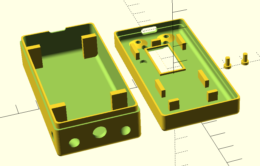
So the only thing left for me was to order and package some 2000 mAh LiPo battery and create an enclosure. I did it with OpenSCAD this time: repo. The total cost turned out to be ~1000 ₴.
![]()
Meshtastic is an open source project, so it can be customized for our use case. For example, to display the direction to the sun and the moon to help navigation when the compass isn’t available.
References:
- Meshtastic in Ukraine
- Meshtastic pet tracker — similar story and application